All Resources

Downtown Folk Tour
Recorded stories from Dr. John Burrison, Folklorist and Professor of English at Georgia State University, who has collected stories of folk music, pottery, legends, medicine,...
Read More

The Great Speckled Bird
The Great Speckled Bird was one of several underground newspapers that appeared in the United States in the 1960s. Published in Atlanta from 1968 to...
Read More
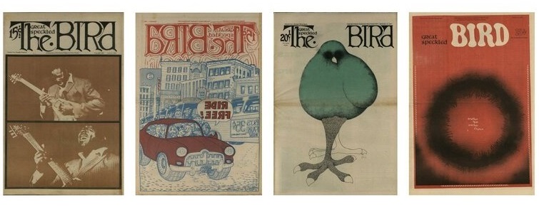
The Great Speckled Bird: What a Beautiful Thought I Am Thinking
The exhibit commemorates the 50th anniversary of the publication of the first issue of The Great Speckled Bird. Content in this exhibit incorporates resources from...
Read More

The Reckoning
Leading up to and after the Women’s March of 2017, Georgia activists, Lucy Hargrett Draper, and her niece, Chrisy Erickson Strum documented emerging and ongoing...
Read More

Out in the Archives: Gender and Sexuality Collections at Georgia State University
Highlights aspects of Atlanta’s LGBTQ+ history that are most fully documented by GSU Archives & Special Collections. The Gender and Sexuality Collections at Georgia State...
Read More

Creative Loafing
Creative Loafing is an alternative newspaper covering arts, entertainment, music, news, and politics in metro Atlanta. The paper was founded in 1972 by Deborah and...
Read More

Bridging Communities: 50 Years of Collecting at Georgia State University
Founded in 1913, Georgia State University grew as it supported the educational needs of Atlanta and the state of Georgia. Originally an evening program intended...
Read More
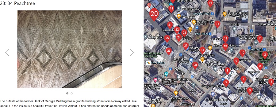
Atlanta Geology Walking Tour
Granite, limestone, and marble building stones are found in a 20-block area that is centered around the beginning of Peachtree Street. These three commercial types...
Read More
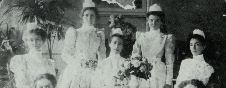
The Art of Nursing & Caring for the Sick and Afflicted: The Grady School of Nursing Legacy
In commemoration of the 120th anniversary of the founding of the Grady Memorial Hospital School of Nursing. The Grady Memorial Hospital School of Nursing, chartered...
Read More

Research Atlanta, Inc. Reports
Formed in 1971, Research Atlanta was a non-profit organization established to study public policy issues affecting the Atlanta metropolitan area. Research Atlanta served as Atlanta’s...
Read More
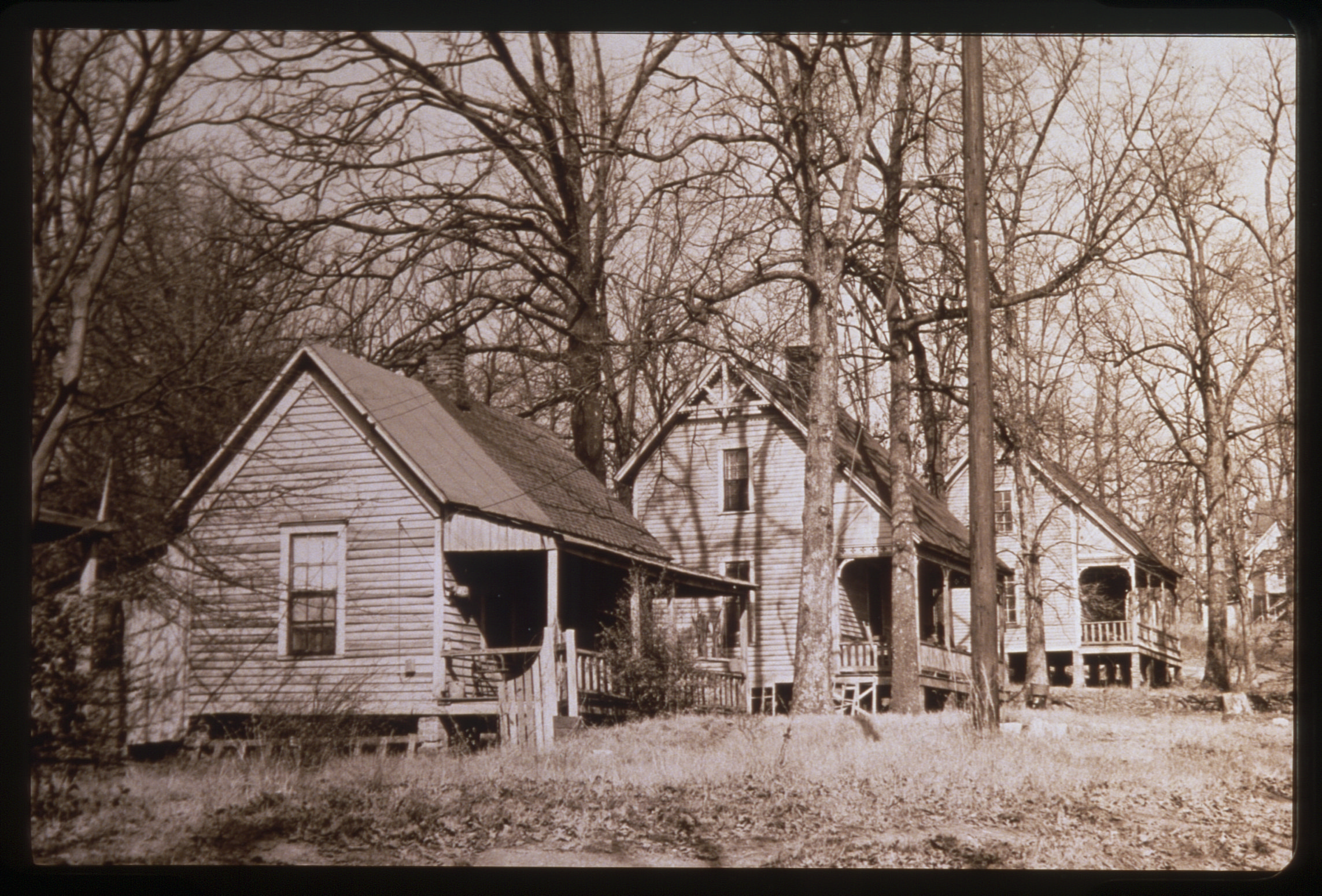
Black Neighborhoods and the Creation of Black Atlanta
Black Neighborhoods and the Creation of Black Atlanta explores the history of Black neighborhoods in Atlanta. It provides an overview of several of these neighborhoods: Summerhill,...
Read More
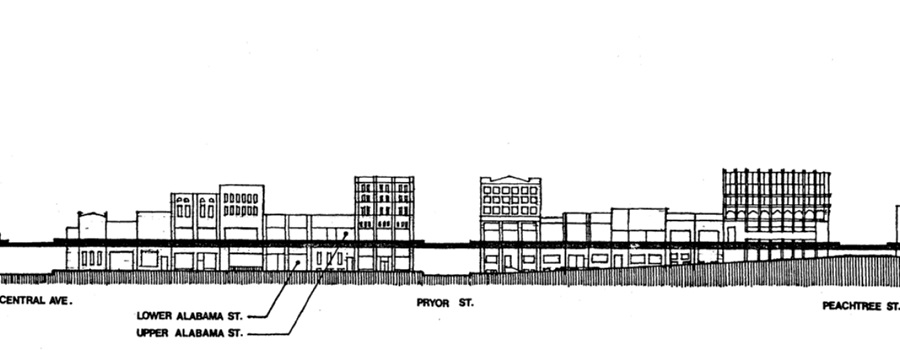
Underground Atlanta Historic District Nomination
National Register of Historic Places Inventory nomination form submitted in 1980. Originally, the two-and-a-half-block area of the Underground district was a part of the larger...
Read More