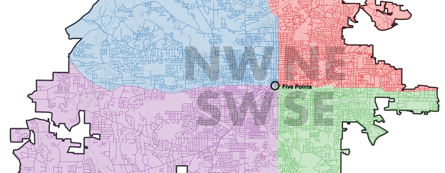
Georgia State University Library See also recent in ScholarWorks
University Library

Recent Atlanta Research from GSU in ScholarWorks

More in ScholarWorks

digATLThe Digital Atlanta Portal

Projects, collections, and data about the metro area produced by Georgia State University faculty, staff, and students working with and within their communities. More ...

Tag: Geography

Mapping Atlanta

GSU professor Taylor Shelton’s blog exploring all of Atlanta’s oddities and inequalities with maps. Issues covered are fundamentally about geography, about how places are the...
Read More

GSU professor Taylor Shelton’s blog exploring all of Atlanta’s oddities and inequalities with maps. Issues covered are fundamentally about geography, about how places are the way they are and how they change over time and how all of that matters to the people that occupy those places. Atlanta is one of the most interesting and unique cities in the US, if not the world, but it’s also one that’s been chronically understudied relative to other large cities. Even if more were written about Atlanta on a consistent basis, the city’s rapid changes necessitate ever more investigation of what’s happening, where and why. Atlanta consistently has some of the highest levels of income inequality of any city or metro across the entire United States. And while the city had a reputation for being one of the most affordable large metros, the last several years have seen some of the most rapid housing price increases of anywhere across the country, with unchecked gentrification running rampant in some historically Black neighborhoods.

Creator
Taylor Shelton is an assistant professor in the Department of Geosciences at Georgia State University, where he teaches classes about maps and data.
Format

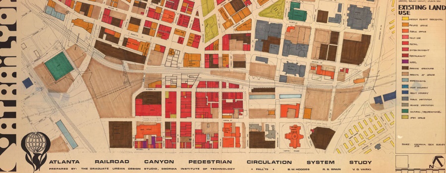
Planning Atlanta – A New City in the Making, 1930s-1990s

Digital collection of material related to city planning and urban development in Atlanta. The collection consists of city planning maps, city planning publications, demographic data,...
Read More

Digital collection of material related to city planning and urban development in Atlanta. The collection consists of city planning maps, city planning publications, demographic data, photographs depicting planning activities, oral histories, and aerial photographs. Much of the Planning Atlanta material was created by the City of Atlanta, the Atlanta Regional Commission (ARC), and the Atlanta Journal-Constitution. Additionally, items from other agencies and entities, such as the Metropolitan Atlanta Rapid Transit Authority (MARTA), are included. Planning Atlanta is a National Endowment for the Humanities (NEH) funded project and seeks to move beyond the traditional digital library model of simply providing digital equivalents of tangible objects. This city planning focused collection provides free and open access to digitally transformed, dynamic, and engaging content with the goal of enhancing this material for educational and research uses. Many items in the collection have been transformed into digital objects that can be engaged with and manipulated. 

ATLMaps

The ATLMaps platform, a collaboration between Georgia State University and Emory University, combines archival maps, geospatial data visualization, and user contributed multimedia location pinpoints to...
Read More

The ATLMaps platform, a collaboration between Georgia State University and Emory University, combines archival maps, geospatial data visualization, and user contributed multimedia location pinpoints to promote investigation into any number of issues about Atlanta. While currently focused on one city to demonstrate the power of stacking thousands of layers of information on one place, this innovative online platform allows users to layer an increasing number of interdisciplinary data to address the complex issues that any city poses. The project looks to offer a framework that incorporates storytelling reliant on geospatial data and for normalizing input across a range of data sets about so that material can be cross-compared in novel ways, allowing users to make connections between seemingly unrelated data sources and ask questions that would not be apparent when only looking at one particular project. The ATLMaps project will also encourage knowledgeable members of the university and local communities to curate data on the site to demonstrate the possibilities for synthesizing material across projects and data types.

Complete list of ATLMaps contributors and past and present team members at https://atlmaps.org/about

Creator
Brennan Collins, Assoc. Director, GSU Center for Excellence in Teaching and Learning for Digital Pedagogy and Atlanta Studies; Megan Slemons, GIS Librarian, Emory Center for Digital Scholarship; Jay Varner, Lead Software Engineer, Emory Center for Digital Scholarship; Tim Hawthorne, Assist. Professor of Geographic Information Systems, Dept. of Sociology, University of Central Florida; Joe Hurley: Ph.D. candidate, School of History and Sociology, Georgia Tech; Ben Miller, Senior Lecturer, Technical Writing & Digital Humanities, Emory University

Heritage Preservation Projects, 1991-Present

The Digital Archive of the Heritage Preservation Program (HPP) available in ScholarWorks @ Georgia State University is a compendium of student projects produced under the...
Read More

The Digital Archive of the Heritage Preservation Program (HPP) available in ScholarWorks @ Georgia State University is a compendium of student projects produced under the supervision of the HPP faculty from 1991 until the present. The Archive contains a variety of completed projects that document buildings and historic areas in and around Metropolitan Atlanta. The projects include Historic Structure Reports of historic or endangered buildings, Historic District Information Forms prepared for submission to the Georgia Historic Preservation Division for eventual National Register Designation, Design Guideline and Planning projects that are intended to assist communities and neighborhoods in making design decisions about Locally Designated Historic Districts and Historic Context studies that focus on a particular building type, period of development (developmental history) or particular community. These documents embody a wide variety of buildings, neighborhoods and communities across Metro Atlanta. They demonstrate the body of work accomplished by the students of the Heritage Preservation Program and are here to be utilized by anyone seeking to research historic places in and around Atlanta.

Creator
Project Advisor Richard Laub, Director, Heritage Preservation Program, Department of History, Georgia State University, and students