Policy & Planning
Featured

The Phoenix Rises: Atlanta’s Olympic Journey
The September 1990 announcement that Atlanta would host the 1996 Olympics surprised and thrilled many Atlantans. The ’96 Summer Games would mark the 100th anniversary...
Read More
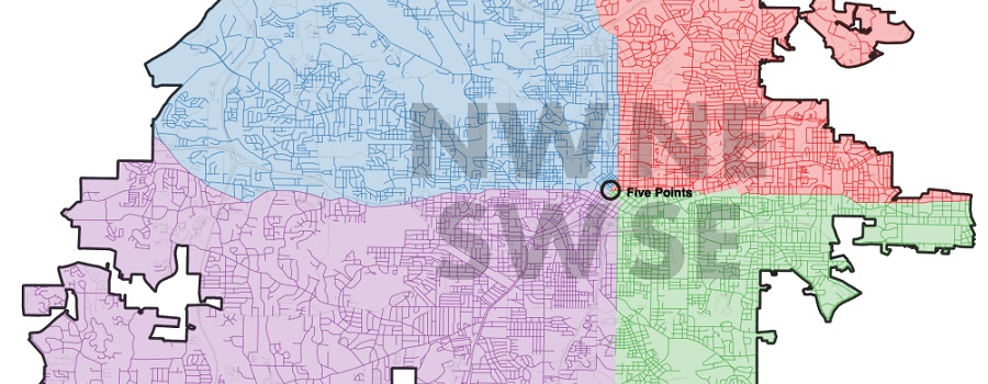
Mapping Atlanta
GSU professor Taylor Shelton’s blog exploring all of Atlanta’s oddities and inequalities with maps. Issues covered are fundamentally about geography, about how places are the...
Read More
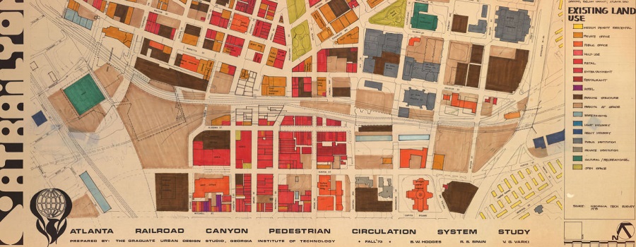
Planning Atlanta – A New City in the Making, 1930s-1990s
Digital collection of material related to city planning and urban development in Atlanta. The collection consists of city planning maps, city planning publications, demographic data,...
Read More

ATLMaps
The ATLMaps platform, a collaboration between Georgia State University and Emory University, combines archival maps, geospatial data visualization, and user contributed multimedia location pinpoints to...
Read More
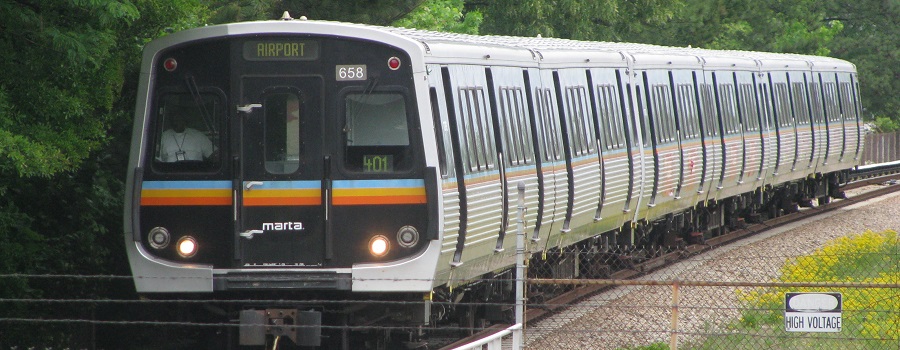
Tracing a History of Atlanta’s Public Transit
Atlanta, originally named Terminus, has a profound history which is extensively intertwined with transit. This project visualizes how the city’s public transit system, now a...
Read More
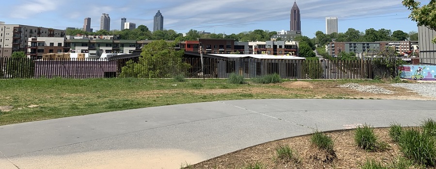
Beltline: A History of the Atlanta Beltline and its Associated Historic Resources
Prepared by the Spring 2006 Preservation Planning students. This project, developed in a collaborative effort by the Atlanta Urban Design commission and GSU students, was...
Read More

Research Atlanta, Inc. Reports
Formed in 1971, Research Atlanta was a non-profit organization established to study public policy issues affecting the Atlanta metropolitan area. Research Atlanta served as Atlanta’s...
Read More
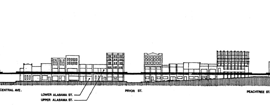
Underground Atlanta Historic District Nomination
National Register of Historic Places Inventory nomination form submitted in 1980. Originally, the two-and-a-half-block area of the Underground district was a part of the larger...
Read More
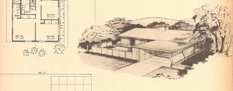
Single-Family Residential Development in DeKalb County, 1945-1970
Focused on suburban residential developments in DeKalb County, Georgia between the end of World War II and 1970 in order to better understand the transformation...
Read More
Heritage Preservation Projects, 1991-Present
The Digital Archive of the Heritage Preservation Program (HPP) available in ScholarWorks @ Georgia State University is a compendium of student projects produced under the...
Read More

Georgia Government Documentation Project
The Georgia Government Documentation Project (GGDP) documents the state’s political heritage through oral history interviews and collections of associated papers. The GGDP collection includes more...
Read More
Sprawling of Atlanta: Visualizing Metropolitan Area Change, 1940s to Present
Interactive web map created by Georgia State University Library that invites researchers, students, and the public to visualize the extensive built environment and demographic changes...
Read More