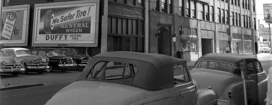
Within Georgia State University Library’s digital collections can be found a series of approximately 100 photographs depicting downtown Atlanta streets in 1927, focusing mainly on the area just south of GSU’s present-day downtown campus. These images were scanned from glass plate negatives owned by the Special Collections of the Atlanta-Fulton Public Library System, which were loaned to GSU Library so that they could be digitized and shared with a wider audience. Of particular interest are images of city streets and storefronts at street level before many were covered over to make way for the “twin viaducts” project of 1927-1929, the city project that elevated the street levels of Central Avenue and Pryor Street (the viaducts) running north to south as well as Alabama and Wall Streets (the laterals) running east to west. This project quite literally entombed the original ground-level streets and storefronts below to become what we now know as Underground Atlanta. Thanks to this unique collection of images, we can return to downtown Atlanta before the construction of these viaducts and elevated streets.
- Visit Resource
- Before Underground
- Creator
- Bryan Sinclair, Georgia State University Library
- Format
- Category
- Arts & Culture
- Related Content
-
Sinclair, Bryan. “Before Underground.” Atlanta Studies. February 15, 2025. https://doi.org/10.18737/atls20250215
- Share